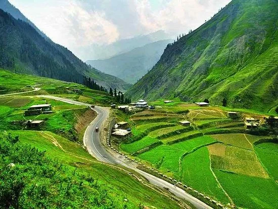
Balakot: Gateway to Kaghan Valley
Balakot is a beautiful town located in the Mansehra District of Khyber Pakhtunkhwa, Pakistan. Surrounded by mountains and flowing rivers, it serves as the main gateway to the famous Kaghan Valley and northern tourist destinations like Naran and Babusar Top.
The town became widely known after the 2005 Kashmir earthquake, which caused major destruction in the region. Today, Balakot has been rebuilt and continues to welcome thousands of tourists every year.
Location of Balakot
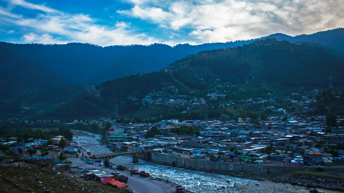
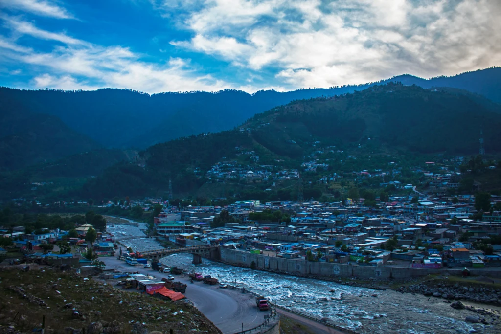
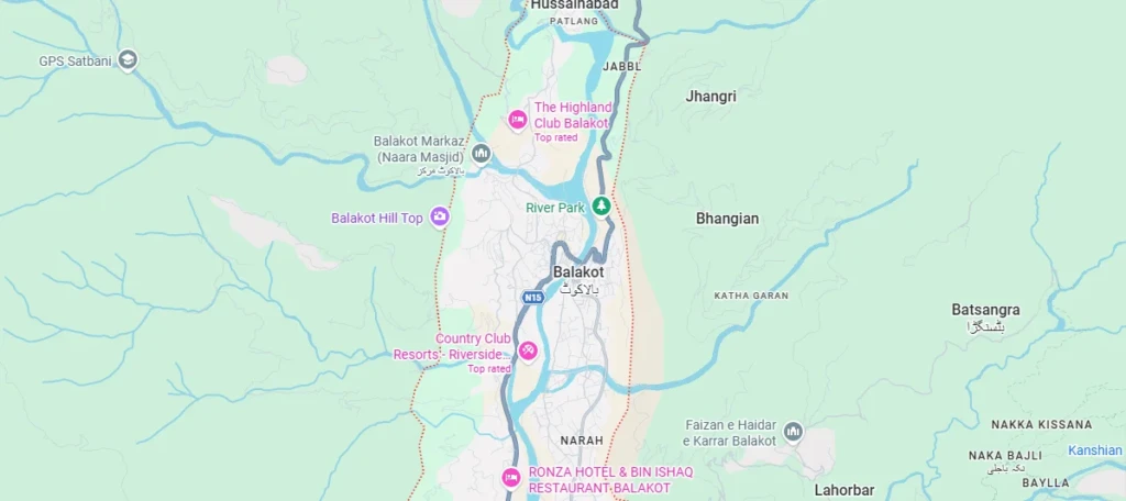
Balakot is located in the Mansehra District of Khyber Pakhtunkhwa, Pakistan. The town lies along the beautiful Kunhar River and serves as the main gateway to Kaghan Valley and other northern tourist destinations.
It is situated approximately:
- 38 km from Mansehra
- 72 km from Naran
- 160 km from Islamabad
Balakot connects travelers to famous destinations such as Naran, Kaghan, and Babusar Pass.
Climate of Balakot
Balakot has a humid subtropical climate with:
- Warm summers
- Cold winters
- Heavy rainfall during monsoon season
The weather remains pleasant during summer, making it a popular escape from the heat of major cities.
Best Time to Visit
The best months to visit Balakot are:
- April to October
During this time, the valley becomes lush green and ideal for sightseeing and road trips.
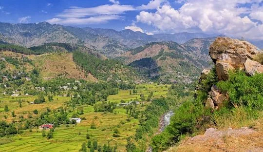
Height of Balakot Valley
Balakot sits at an elevation of approximately 3,200 feet above sea level. As travelers move further into Kaghan Valley, the altitude gradually increases and reaches around 13,700 feet at Babusar Pass.
This change in elevation creates diverse landscapes, weather conditions, and breathtaking mountain views throughout the journey.
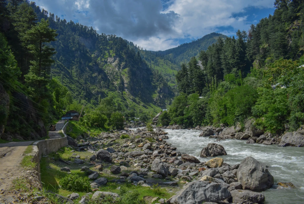
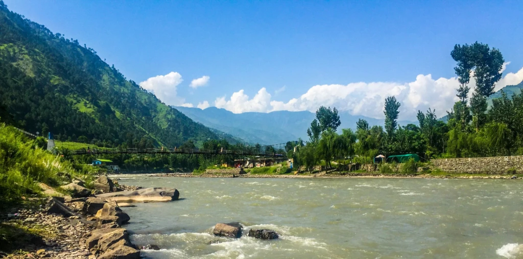
River Kunhar – The Beauty of Balakot
The Kunhar River is one of the most famous rivers in northern Pakistan and the heart of Balakot’s natural beauty.
About River Kunhar
- Length: Approximately 177 km
- Source: Lulusar Lake near Babusar Pass
- Water Source: Snowmelt and natural streams
- Endpoint: Joins the Jhelum River near Pattan
The flowing turquoise water of River Kunhar adds charm to Balakot and attracts photographers, campers, and tourists throughout the year.
History of Balakot
Balakot also holds historical importance. Archaeologists believe the area was connected to the ancient Indus Valley Civilization around 2000 BC.
The region has attracted researchers and historians due to its archaeological significance and ancient settlements.
The 2005 Earthquake and New Balakot City
In 2005, a devastating earthquake severely damaged Balakot and nearby areas. After the disaster, authorities proposed relocating residents to a new settlement called New Balakot City near Bakrial.
The goal was to move people away from geological fault lines and create safer residential areas. Although reconstruction faced delays, Balakot gradually recovered and tourism returned to the valley.
Things to Do in Balakot
Enjoy River Views
The Kunhar River offers peaceful scenery and relaxing picnic spots.
Explore Kaghan Valley
Balakot is the starting point for travelers visiting Kaghan, Naran, and Babusar Top.
Photography
The mountains, forests, and rivers make Balakot ideal for landscape photography.
Road Trips
Many tourists use Balakot as a stop during northern Pakistan road trips.
Travel Tips for Visitors
- Carry warm clothes even during summer
- Check weather conditions before traveling
- Start road trips early in the morning
- Avoid traveling during heavy rainfall
- Book hotels early during tourist season
Why You Should Visit Balakot
Balakot combines natural beauty, river scenery, mountain landscapes, and cultural history in one destination. Whether you are planning a family trip, a northern road adventure, or a peaceful getaway, Balakot offers a memorable travel experience.
Its location as the gateway to Kaghan Valley makes it one of the most important tourist towns in northern Pakistan.
FAQs
Where is Balakot located?
Balakot is located in Mansehra District, Khyber Pakhtunkhwa, Pakistan.
Why is Balakot famous?
Balakot is famous as the gateway to Kaghan Valley and for its scenic location along River Kunhar.
What is the best time to visit Balakot?
April to October is considered the best time for tourism.
Which river flows through Balakot?
The Kunhar River flows through Balakot.
Is Balakot safe for tourists?
Yes, Balakot is a popular and commonly visited tourist destination in northern Pakistan.
Explore More Beautiful Destinations
Continue exploring the beauty of Northern Pakistan with more breathtaking destinations:
- Nathia Gali Travel Guide
- Ghora Gali Travel Guide
- Noori Waterfall Guide
- Karlan Waterfall Guide
- Banjosa Lake Travel Guide
- Upper Kachura Lake Guide

67 Comments
SDiozxswidly
профиль с подписчиками купить аккаунт с прокачкой
Zazacwidly
покупка аккаунтов маркетплейс аккаунтов
Olasxwidly
биржа аккаунтов перепродажа аккаунтов
SDiozxswidly
продажа аккаунтов соцсетей маркетплейс аккаунтов соцсетей
Zazacwidly
покупка аккаунтов магазин аккаунтов
Josephwidly
заработок на аккаунтах маркетплейс аккаунтов
RobertTig
купить аккаунт с прокачкой купить аккаунт
Olivewidly
маркетплейс аккаунтов маркетплейс аккаунтов
Droswidly
заработок на аккаунтах маркетплейс аккаунтов соцсетей
Olivewidly
маркетплейс аккаунтов площадка для продажи аккаунтов
Peterdaw
продать аккаунт заработок на аккаунтах
RichardTen
маркетплейс аккаунтов magazin-akkauntov-online.ru/
JamesCledo
магазин аккаунтов покупка аккаунтов
Olivewidly
продажа аккаунтов маркетплейс аккаунтов соцсетей
Bryantbeini
профиль с подписчиками продажа аккаунтов соцсетей
RichardTen
профиль с подписчиками гарантия при продаже аккаунтов
DavidNaisk
Accounts market Account Selling Platform
JasonRah
Account Buying Platform Buy Account
MichaelMibra
Account Selling Platform Purchase Ready-Made Accounts
WalterFlact
Accounts market Account trading platform
JaredSoals
Buy Account Account Exchange Service
BrianCoaps
Account Buying Platform Account Store
Ronaldhex
Secure Account Purchasing Platform Account Acquisition
BruceCUBOW
Account Buying Platform Purchase Ready-Made Accounts
Williamsep
Account Catalog Sell accounts
Ronaldhex
Sell Account Buy Account
BrandonGuede
purchase ready-made accounts account selling platform
EdmundDeats
gaming account marketplace account purchase
RomeoGaH
online account store account market
DonaldSab
database of accounts for sale sell pre-made account
Keithvet
account trading online account store
RobertGeasy
online account store accounts marketplace
Hectorwem
account acquisition account trading service
CarlosMar
account marketplace account store
Richardusero
secure account sales account market
Stephentraky
account catalog account market
Carlosjeape
website for buying accounts ready-made accounts for sale
Clydedoulp
account exchange accounts for sale
JohnnyDot
account catalog guaranteed accounts
Stevenslace
purchase ready-made accounts verified accounts for sale
ThomasPouff
website for selling accounts gaming account marketplace
PhilipDib
social media account marketplace sell account
RandalOxilt
find accounts for sale secure account sales
RichardMouse
website for selling accounts account trading platform
Zacharymax
account marketplace buy account
Kevinjoipt
account trading https://account-buy.org
Thomasnussy
account marketplace secure account purchasing platform
NathanKiz
accounts for sale account trading service
BruceObere
buy and sell accounts account acquisition
Danielnot
account marketplace account buying platform
Jasonvon
secure account sales database of accounts for sale
Geraldmox
secure account sales account exchange
ThomasBeada
buy account account buying platform
accounts-offer.org_Cousy
account market https://accounts-offer.org/
accounts-marketplace.xyz_Cousy
account exchange https://accounts-marketplace.xyz/
buy-best-accounts.org_Cousy
marketplace for ready-made accounts account marketplace
social-accounts-marketplaces.live_Cousy
account market accounts market
accounts-marketplace.live_Cousy
find accounts for sale accounts market
social-accounts-marketplace.xyz_Cousy
account buying service https://social-accounts-marketplace.xyz
buy-accounts.space_Cousy
verified accounts for sale account market
buy-accounts-shop.pro_Cousy
account buying platform https://buy-accounts-shop.pro/
buy-accounts.live_Cousy
secure account sales account market
accounts-marketplace.online_Cousy
secure account sales https://accounts-marketplace.online
accounts-marketplace-best.pro_Cousy
accounts marketplace https://accounts-marketplace-best.pro
akkaunty-na-prodazhu.pro_Cousy
маркетплейс аккаунтов купить аккаунт
rynok-akkauntov.top_Cousy
магазин аккаунтов rynok-akkauntov.top
kupit-akkaunt.xyz_Cousy
площадка для продажи аккаунтов kupit-akkaunt.xyz